Podcast: Play in new window | Download
Subscribe: RSS
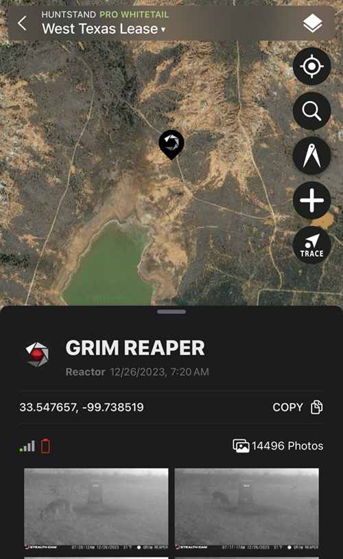
Perhaps no technological advancement has changed the game more than mapping applications over the past decade. From providing valuable property line/landowner data to now being able to predict peak rut dates by region for whitetail deer. Not to mention all the features that allow you to mark everything from bedding areas to blinds, feeders, wallows, rubs and everything else under the sun right there on your cell phone.
HuntStand’s Josh Dahlke joins me on this episode and we discuss the history of mapping applications and how they’ve evolved so quickly. We get into some of HuntStand’s unique features like the Nationwide Whitetail Rut Predictor, Cell Camera integration, solunar tables and peak feeding times, 3D imaging and much more. Of course we also recap our deer seasons and Josh shares his success on his biggest buck to date.

Leave A Comment